


063EW1 - ELLENWOOD Voting District, Clayton County, Georgia
About
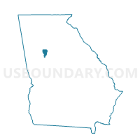
Outline

Summary
| Unique Area Identifier | 560731 |
| Name | 063EW1 - ELLENWOOD Voting District |
| County | Clayton County |
| State | Georgia |
| Area (square miles) | 7.63 |
| Land Area (square miles) | 7.61 |
| Water Area (square miles) | 0.02 |
| % of Land Area | 99.80 |
| % of Water Area | 0.20 |
| Latitude of the Internal Point | 33.62388880 |
| Longtitude of the Internal Point | -84.28859930 |
Maps


Graphs
Select a template below for downloading or customizing gragh for 063EW1 - ELLENWOOD Voting District, Clayton County, Georgia


Neighbors
Neighoring Voting District (by Name) Neighboring Voting District on the Map
- 063LC1 - LAKE CITY Voting District, Clayton County, GA
- 063MO1 - MORROW 1 Voting District, Clayton County, GA
- 063MO3 - MORROW 3 Voting District, Clayton County, GA
- 063MO5 - MORROW 5 Voting District, Clayton County, GA
- 089CS - CEDAR GROVE SOUTH Voting District, DeKalb County, GA
- 15146 - SHAKERAG Voting District, Henry County, GA
Top 10 Neighboring County Subdivision (by Population) Neighboring County Subdivision on the Map
- Atlanta-Decatur CCD, DeKalb County, GA (355,979)
- Forest Park-Morrow CCD, Clayton County, GA (91,196)
- Stockbridge CCD, Henry County, GA (58,796)
Top 10 Neighboring Place (by Population) Neighboring Place on the Map
Top 10 Neighboring Unified School District (by Population) Neighboring Unified School District on the Map
- DeKalb County School District, GA (644,266)
- Clayton County School District, GA (259,424)
- Henry County School District, GA (203,922)
Top 10 Neighboring State Legislative District Lower Chamber (by Population) Neighboring State Legislative District Lower Chamber on the Map
- State House District 76, GA (57,823)
- State House District 90, GA (57,061)
- State House District 60, GA (39,431)
Top 10 Neighboring State Legislative District Upper Chamber (by Population) Neighboring State Legislative District Upper Chamber on the Map
Top 10 Neighboring 111th Congressional District (by Population) Neighboring 111th Congressional District on the Map
Top 10 Neighboring Census Tract (by Population) Neighboring Census Tract on the Map
- Census Tract 404.11, Clayton County, GA (12,101)
- Census Tract 234.23, DeKalb County, GA (8,750)
- Census Tract 404.10, Clayton County, GA (7,058)
- Census Tract 404.09, Clayton County, GA (5,716)
- Census Tract 701.08, Henry County, GA (5,393)
- Census Tract 234.22, DeKalb County, GA (5,156)
- Census Tract 404.07, Clayton County, GA (3,622)